
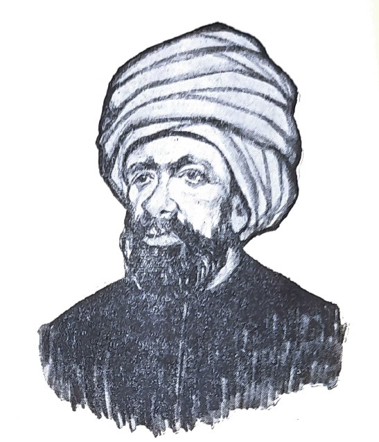

When measuring the Earth comes up at school, Eratosthenes is usually the name mentioned. In the eleventh century, however, another great scholar, Abu Rayhan al-Biruni, proposed a different approach. He did not measure a long arc of the meridian between two cities. He showed that, under certain conditions, one mountain, a few angles and skilful use of trigonometry would suffice. This is what makes his method memorable: a problem in geodesy reduces to a clear geometric diagram.
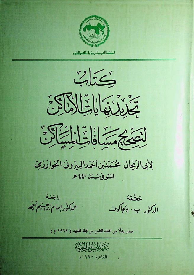
Al-Biruni was born in Khwarazm in 973 and became one of the Islamic world’s greatest scholars. He studied astronomy, mathematics, geography, chronology, history and natural science. Britannica, the authoritative English-language encyclopedia, calls him one of the most original polymaths of the medieval East. MacTutor, the University of St Andrews’ history-of-mathematics archive, particularly notes his contributions to geodesy and triangulation. His treatise Taḥdīd nihāyāt al-amākin li-taṣḥīḥ masāfāt al-masākin, usually shortened to Tahdid, is regarded as his principal work on mathematical geography.
Al-Biruni was not only an astronomer and mathematician but also an outstanding geographer. He was interested in the coordinates of cities, the Earth’s dimensions, ways to measure distances, and the relationship between observation, maps and numbers more generally. It is no accident that a map of the distribution of land and sea is also associated with his name: for him, geography was an exact science of the Earth’s space, rather than a description of the world’s wonders.
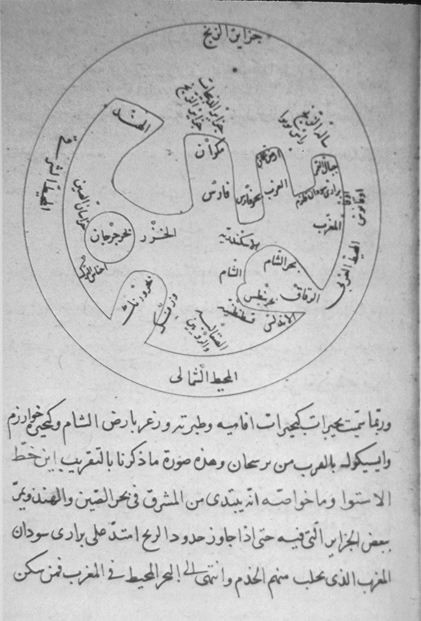
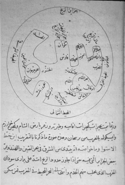
Before al-Biruni, attempts to determine the Earth’s size usually involved measuring an arc: finding the surface distance corresponding to a change of one degree in latitude. Eratosthenes followed this approach, as did the Arab surveyors of al-Ma’mun’s era. The method worked, but required substantial fieldwork: long measurements on the ground, careful establishment of a direction, and reliable distance estimates. Against this background, al-Biruni’s idea offered a different approach: replace a long arc with one isolated mountain and observations of the horizon from its summit. Britannica explicitly contrasts this with earlier measurements of a meridian arc.
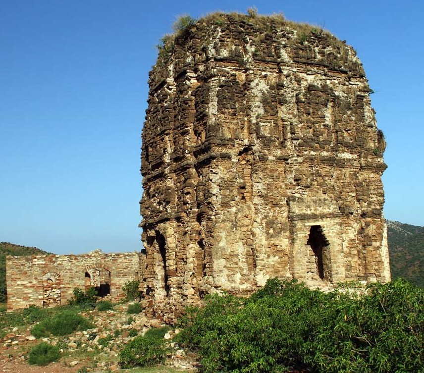
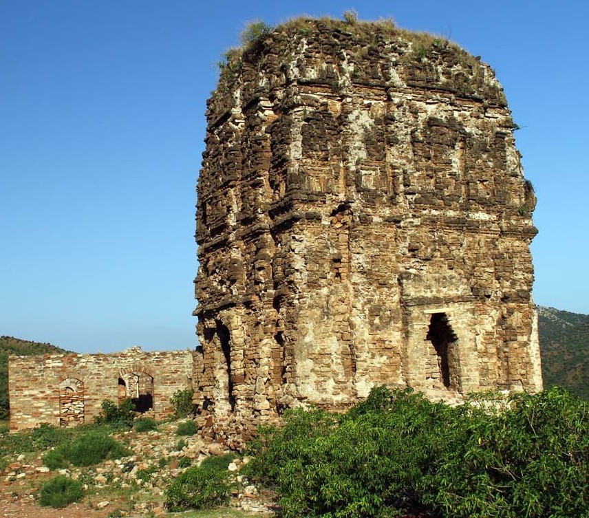
Al-Biruni is traditionally associated with the fortress of Nandana in present-day Pakistan. UNESCO materials identify Nandana as the place where he calculated the Earth’s radius and circumference in 1018. This location has long been established in scholarly and popular literature, although details of his observations are still discussed. What matters more here is that al-Biruni really did describe the method, which became a classic example of medieval geodesy.
Al-Biruni’s method
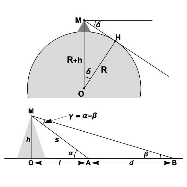
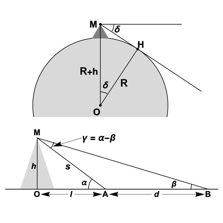
It is useful to divide the method into two steps.
First, determine the mountain’s height. Measure the angles of elevation of its summit from two points on a plain lying on the same straight line towards the mountain. If the distance between the points is d and the elevation angles are α and β, the height h is given in modern notation by:
This is already a good school trigonometry problem. Modern discussions emphasise that al-Biruni first found the mountain’s height before proceeding to the second, principal stage.
He then climbed to the summit and measured the dip of the horizon. Seen from the summit, the visible horizon lies slightly below the ideal horizontal at the observation point. Denote this small angle by δ. The right triangle formed by the Earth’s centre, the mountain summit and the point where the line of sight touches the surface gives:
where R is the Earth’s radius.
Hence
The full power of al-Biruni’s idea is now clear. The planet’s enormous radius is expressed through one mountain’s height and a very small angle. Historians of science and cartography describe precisely this geometry of the method.
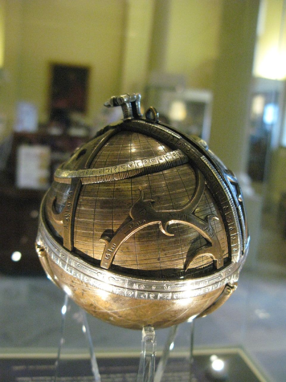
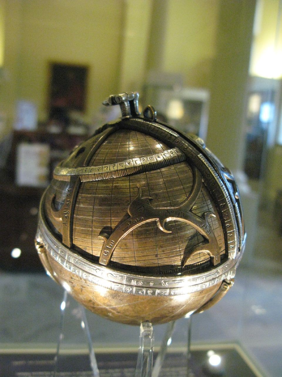
Medieval astronomy and geodesy used angle-measuring instruments for such observations, especially astrolabes and their variants. We have already discussed them in our article The Astrolabe.
There is a simple mathematical idea here. The angle δ is very small, only a few minutes of arc. The denominator is therefore close to zero, which is why the radius comes out so large. Using approximation theory, as δ ⟶ 0 we can write:
1 − cos δ ≈ δ² / 2
And as δ ⟶ 0, cos δ tends to 1.
Then
R ≈ 2h / δ²
provided δ is measured in radians.
To make the formulas concrete, it helps to do a small calculation. Take a mountain height h ≈ 313 m and a horizon dip δ = 34′. The formula above gives a radius of approximately 6.4 × 10⁶ m, or about 6400 km. This is already very close to the Earth’s actual scale. That is why al-Biruni’s result is so often cited as a striking example of the accuracy of medieval science. Modern authors caution, however, that much depends on reconstructing the original units and on whether atmospheric refraction is taken into account.
Al-Biruni’s result is traditionally converted to a value of about 6339.6 km. MacTutor gives this figure and adds that comparable accuracy was not achieved in Europe until the sixteenth century. The number should nevertheless be treated cautiously. Modern researchers identify at least two difficulties. First, medieval units of length cannot be converted into modern kilometres entirely unambiguously. Second, al-Biruni apparently made no correction for atmospheric refraction, which becomes significant at such a small angle. The more honest assessment is therefore this: his method was brilliant, while its famous “almost perfect accuracy” depends on how the conditions of the calculation are reconstructed.
A short problem inspired by al-Biruni
Observers stand at two points on the same straight line towards a mountain. The distance between them is d = 1000 m, and the angles of elevation of the summit from the two points are 35° and 25° respectively. What is the mountain’s height?
Solution. Use the mountain-and-Earth diagram earlier in the article. The mountain’s height is:
Calculating gives approximately:
h ≈ 1396 m
This is, of course, a modern teaching example based on al-Biruni’s scheme, rather than his historical measurement. It does show, however, that the entire construction rests on accessible school trigonometry.
Afterword
The history of science is especially interesting when a clear idea lies behind an elegant formula. Al-Biruni matters not only because he obtained a good value for the Earth’s radius. His reasoning matters far more: angular observations and trigonometry in place of difficult, exhausting measurements on the ground. For the eleventh century, this was a powerful step. Measuring the Earth with a view from a mountain summit rather than by walking across a plain combines rigour, rare simplicity and a distinctly engineering way of thinking.